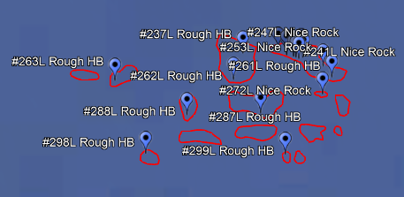
Our waypoints charts, like the St Pete Offshore chart, are all made from high resolution side-scan sonar data. We manually review the sonar data, hundreds of square miles, and only mark spots that we would want to fish ourselves.
We mark features like ledges, rugged hard bottom, sink holes, wrecks, rock piles, and more. Our accuracy is normally within 3 feet. If we mark a spot, it’s probably worth fishing.

StrikeLines waypoint charts get data that’s unique to StrikeLines, fishing spots that don’t exist anywhere else. You’re not buying public numbers, NOAA data, or some captain’s 40 year old book of numbers converted from LORAN. With a StrikeLines waypoint chart you’re getting guaranteed spots from high resolution sonar data.
Our wrecks charts, on the other hand, are made up of publicly available ENC data from NOAA. We find ENC data to be more accurate and more current than AWOIS data, which is what many navigation charts use.
We have not verified the ENC wrecks with sonar; we simply repackage the data in a format that’s easy to install in your chart plotter. That’s why the wrecks charts are so inexpensive.
The downside is that NOAA data can be tens of years old and inaccurate, unlike our waypoints charts. In addition, the wrecks aren’t named so if you’re looking for a specific wreck, these charts probably won’t help you.


If you’re looking for great new fishing spots, our waypoints charts are what you need – incredible accuracy, great features, and guaranteed results. If you want to go exploring and maybe find a new spot to dive or fish, a wrecks chart may be a great fit.