StrikeLines Charter
Charter Sonar — Special Projects — Resources
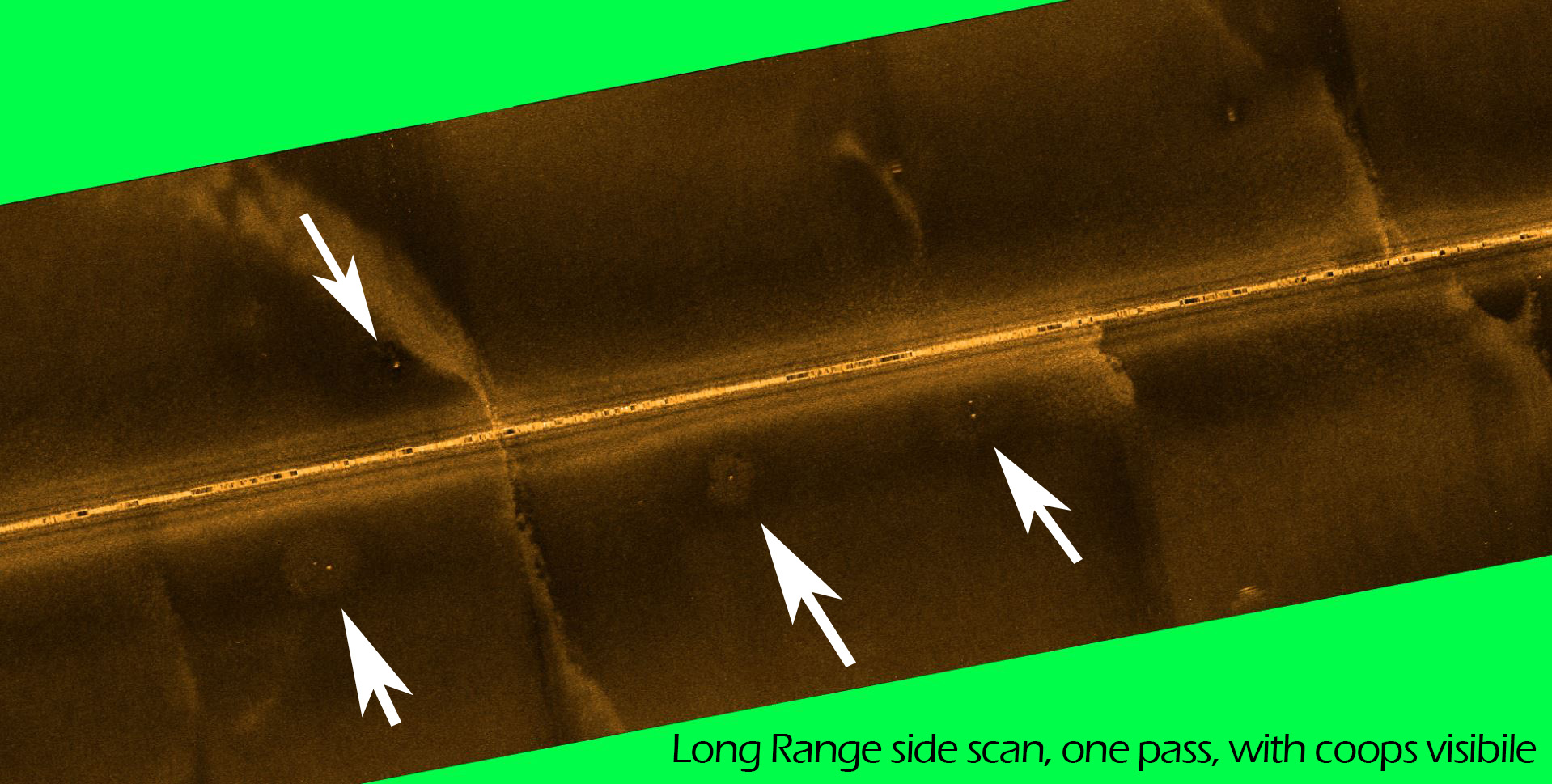
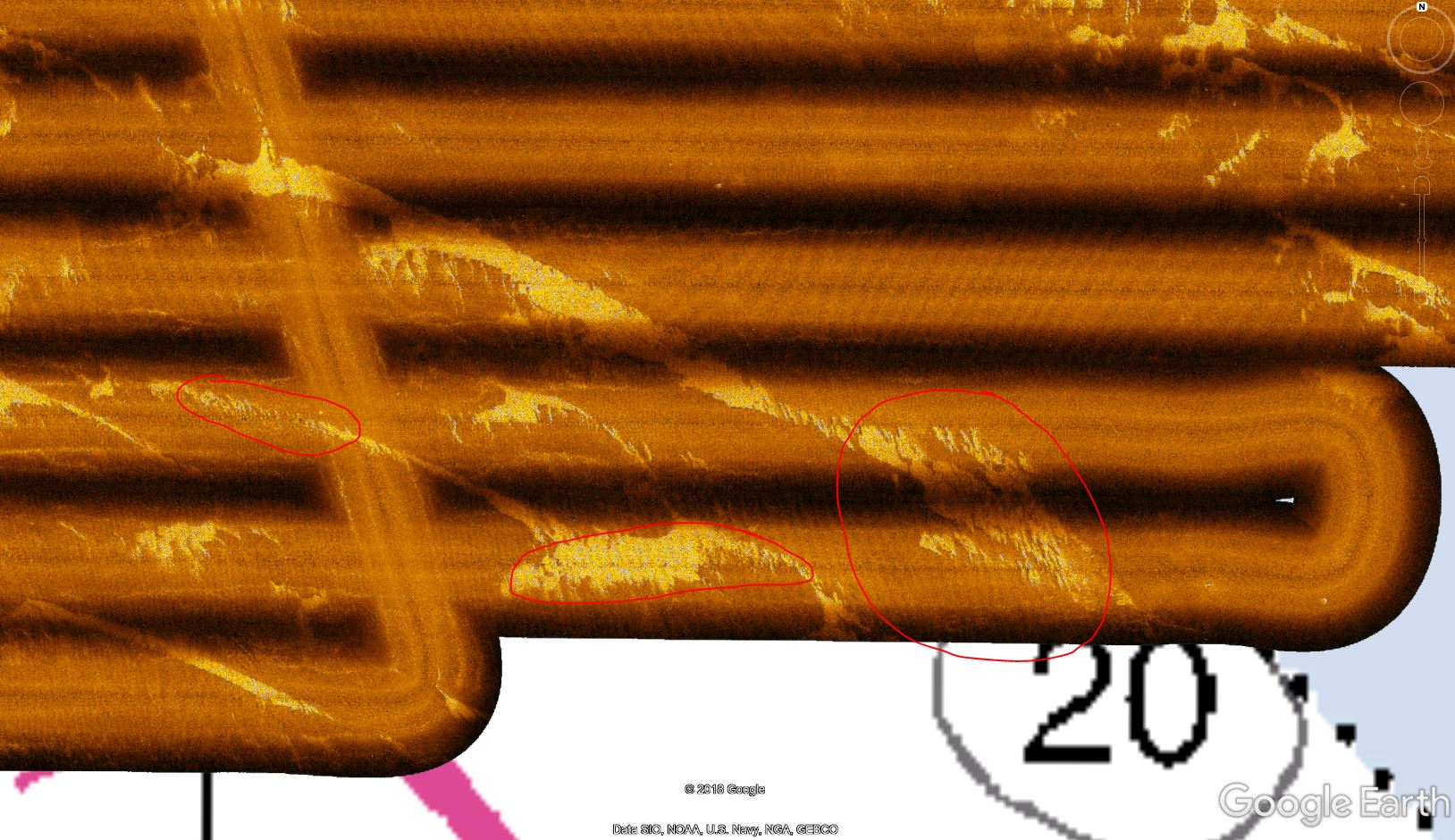
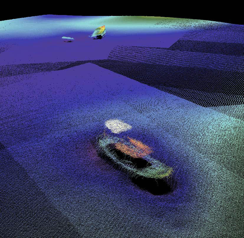
Charter Sonar Scans
Need a pile of private reefs? Charter a StrikeLines sonar scan of your favorite fishing grounds.
Rate: $150-200 per square mile.
Minimum size: 25 sq.mi. ($3,750-$5,000 total cost)
Typical Reefs Found: 25-40 private reefs in a 25 sq.mi. scan.
Time to complete: 1-3 weeks after deposit.
What you get: After the scan, we process the sonar data, mark up all the potential reefs, and give you the following:
- Map of raw sonar data in Google Earth KMZ format.
- A MicroSD card containing all of your reef coordinates. Ready to upload to your GPS chartplotter or Google Earth.
- A spreadsheet of all the reef names and coordinates.
Notes:
Special Projects
Use our resources and expertise to complete a wide variety of challenging marine projects. Some successful past projects:
- Sonar and ROV services for USAF search and recovery mission south of Hurlburt Field.
- Location, floating and recovery of 8-foot stainless steel tugboat propeller lost near Pensacola Pass.
- Charter sonar boat and captain provided to Finnish Navy for testing sonar systems in Pensacola Bay.
- Over 6,000 sq. mi. of charter sonar scans, locating 9,000+ private artificial reefs from Gulfport to Panama City Beach.
- Shallow water side-scan sonar imaging of oyster bars for marine researchers.
- Tournament scouting: ROV monitoring of fish populations on hundreds of offshore artificial reefs.
Our Resources:
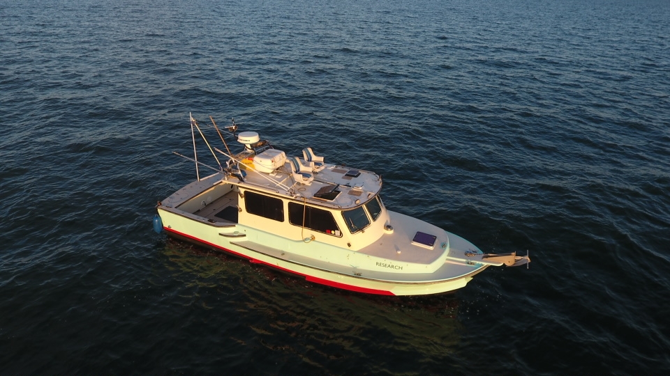
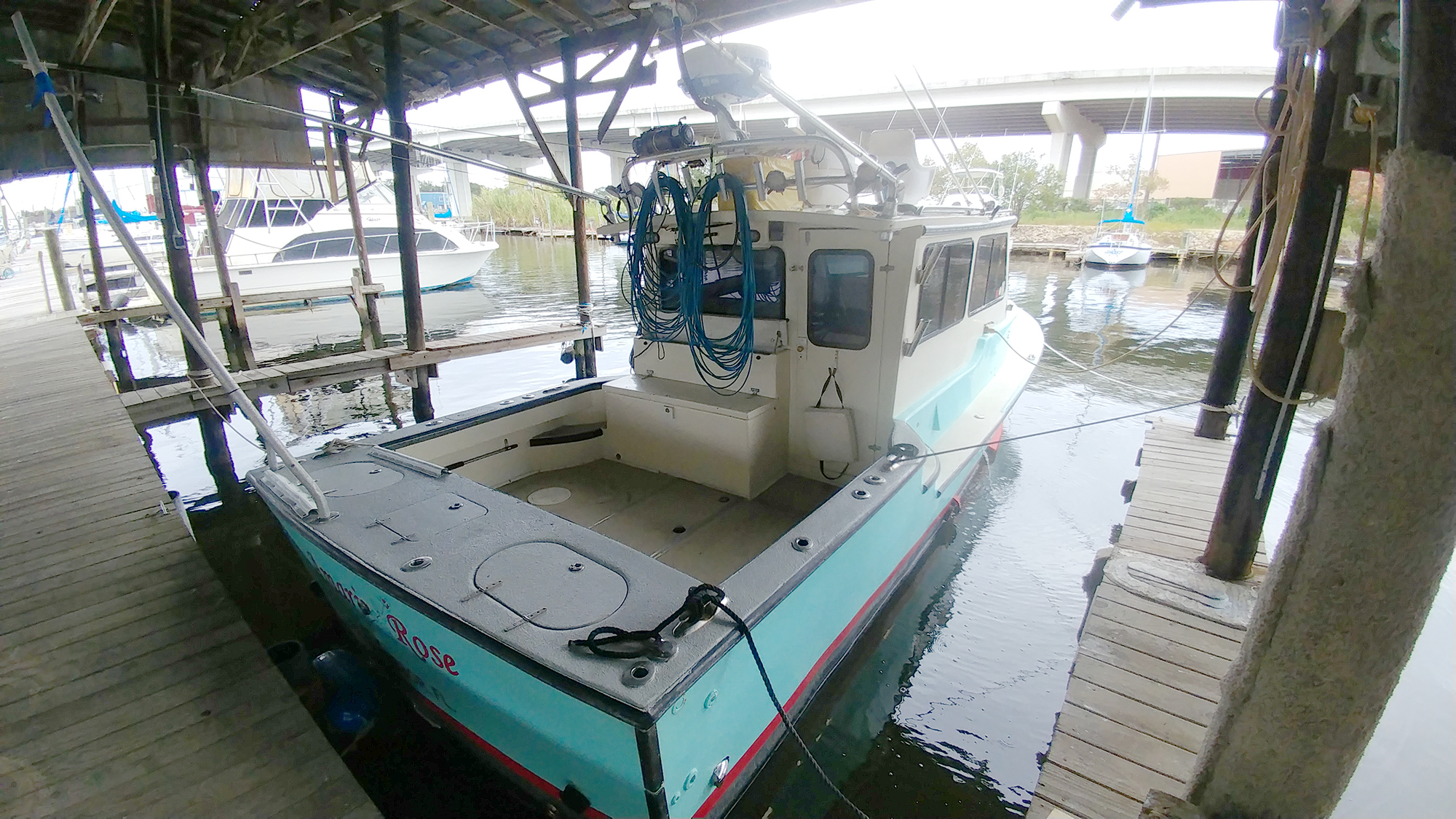
- 35′ Custom offshore work boat. 400 hp. 5-day endurance.
- 22′ Glacier Bay center console catamaran.
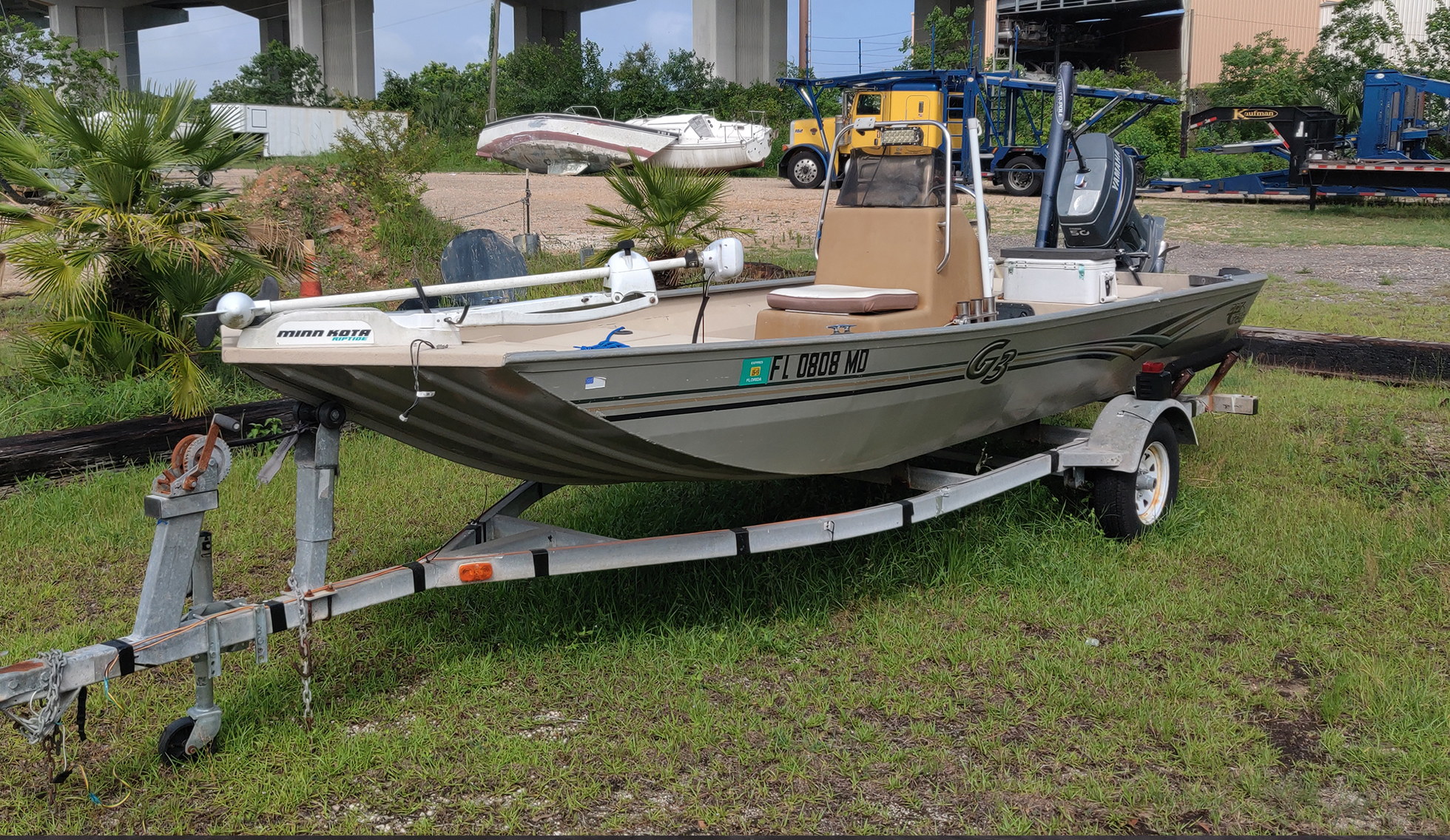
- 17′ Aluminum G3 shallow water boat.
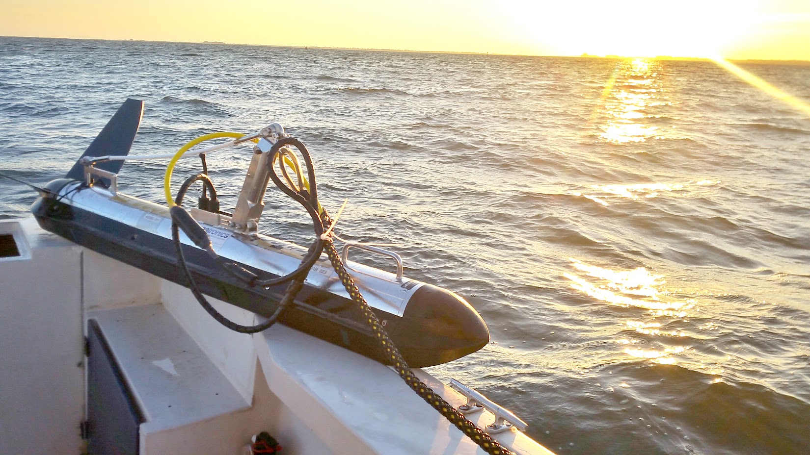
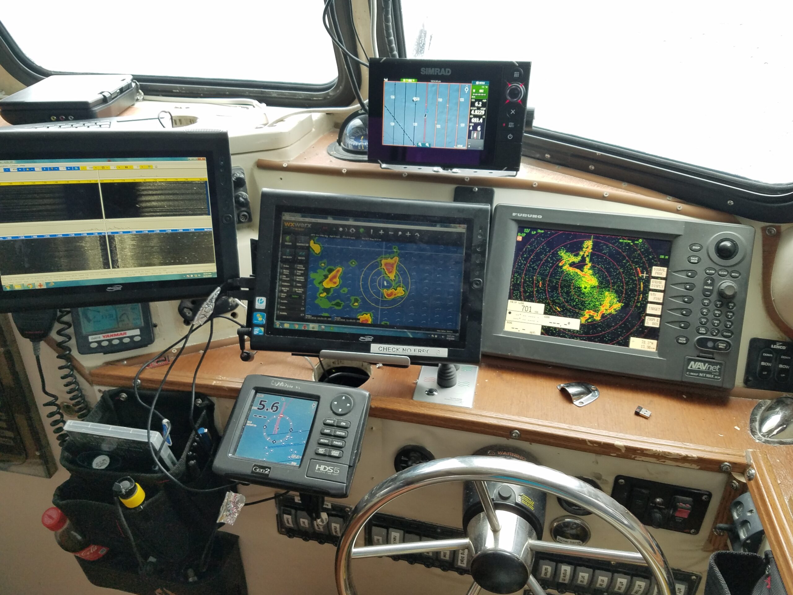
- High resolution (400/800khz) side scan towfish. (several models)
- Long range (100khz) side scan towfish. (multiple models)
- BlueROV2 inspection-class underwater ROVs. Real-time HD video feed and 360-degree scanning sonar.
- USCG Licensed Captains.
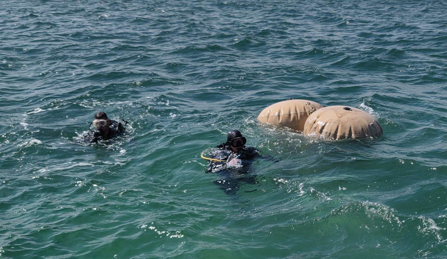
- Commercial divers.
- Heavy lift bags and rigging.
- Aerial camera drones.
- Metal and fiberglass fabrication.
- GIS mapping, data analysis, and coordinate conversions.
- Electronics troubleshooting and repair.
- Office and warehouse at Pelican’s Perch marina. Wet slips, boat yard, travel lift, and full marina services available.
- GSA Approved.


