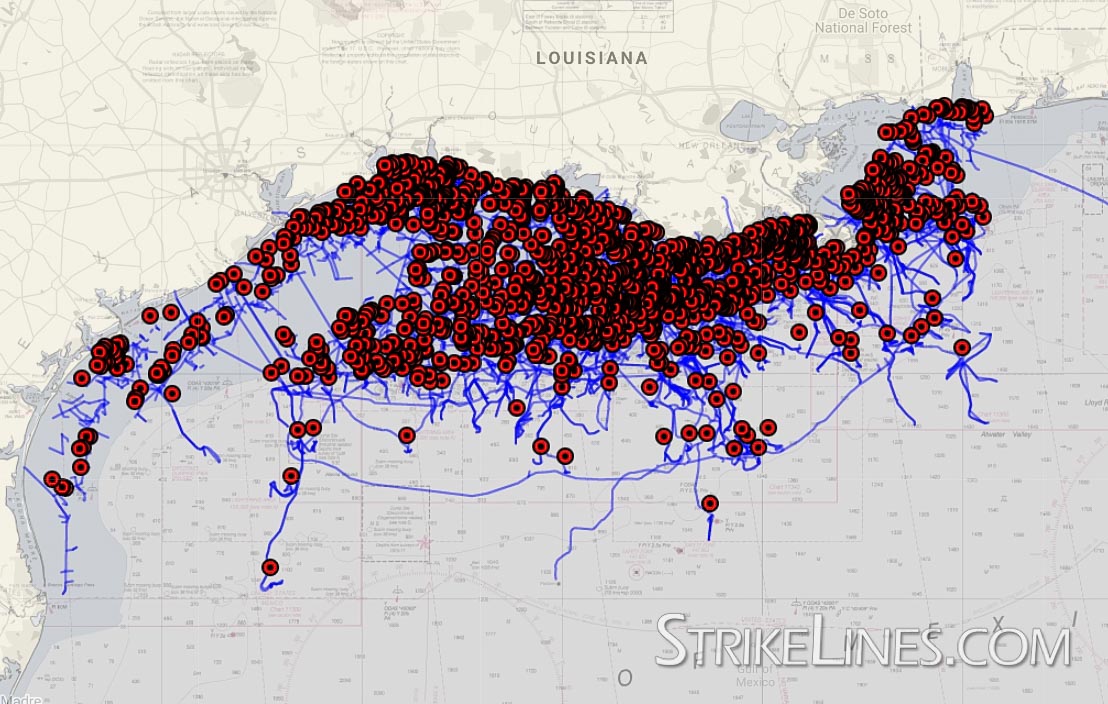
Gulf of Mexico Oil Rig Platforms & Pipelines
$0 – $99
Gulf of Mexico Oil Rig Platforms & Pipelines Fishing Map – 2020 (FREE to download)
The first StrikeLines Custom Chart, available for free and updated January 12, 2020.
We made this fishing map of the Gulf of Mexico offshore oil rig platforms and pipelines using Bureau of Ocean Energy Management data. It took quite a bit of effort! We had to build a relational database three tables deep just to connect a rig name to its location! Now there’s an easy to use downloadable fishing map for the Gulf of Mexico oil rigs.
BOEM, please be more like Florida and Alabama. Think of the fishermen.
When fishing pipelines, be aware that the pipe might be buried for much of its length. But the pipe may occasionally rise above the sand or mud to connect to the next section at junction boxes. Note that many chart plotters cannot load the pipeline files due to the number of points in the tracks required to accurately trace the pipelines. If this happens, you can view the pipelines (and platforms) in Google Earth or a free program like EasyGPS.
The platforms, provided in GPX files, are broken into two categories:
- Platforms without a removal date (“NRD”). Platforms that, in the BOEM data, do not have a removal date. Most of the 1,403 platforms should exist.
- All platforms. Includes all platforms, both those with and without removal dates. Note that a removal date does not guarantee it was removed. Be careful out there!
These categories are further divided into West, Central West, Central East, and East. For example, you could import just the platforms without a removal date for the western section.
The name field includes the Complex ID of the rig. The description or comment field includes block number, complex ID, platform name when available, distance to shore, depth, whether the platform is attended 8 hours, whether it is manned 24 hours a day, number of decks, number of beds if applicable, date the platform was installed, and date the platform was removed if applicable. Note that most Raymarine and Garmin units will not load more than the first 30 or so characters of the description.
We spent several days processing, compiling, editing, cursing, and eventually exporting the BOEM data. While the source data is free and available here, the resulting StrikeLines files are subject to our terms and conditions and may not be distributed without our express, written permission. Don’t hesitate to ask though; we’re nice people.


