


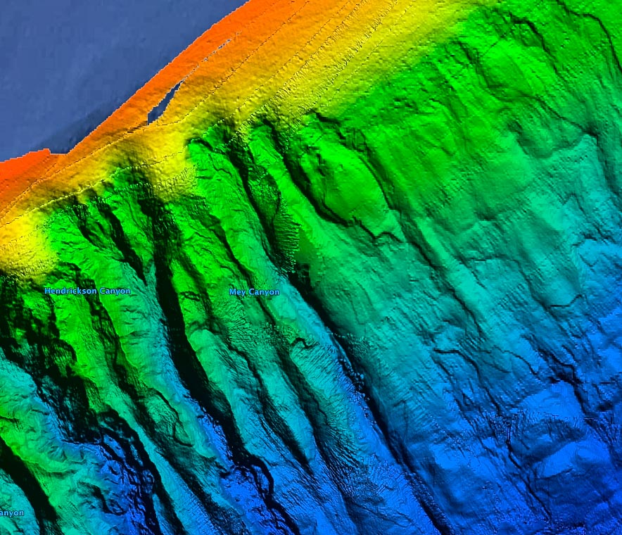


3D New York Canyons
$349
New York Canyons fishing map 3D – Hudson Canyon, Block Canyon (Fish Tails), Ryan Canyon, McMaster Canyon
**Preview map is LOW RESOLUTION. See gallery below for HD sample images**
- Description: New York Canyons fishing map features high definition 3D images of the seafloor.
- Location: New York Canyons high resolution fishing chart coverage includes fishing hot spots of Hudson Canyon, Block Canyon (Fish Tails), Ryan Canyon, McMaster Canyon. Other canyons and valleys included in the New York 3D fishing map are: Alvin Canyon, Uchupi Canyon, Babylon Canyon, Jones Canyon, Mey Canyon Hendrickson Canyon, Middle Toms Canyon, Berkeley Canyon, Carteret Canyon, Spencer Canyon, South Wilmington Canyon, Hudson Valley, Heezen Plateau, Carstens Valley. Noteworthy distance from shore to fishing map points of interests: 95 miles south of Rhode Island, 81 miles south of Block Island Sound, 87 miles southeast of East Patchogue, 110 miles southeast of Staten Island, 80 miles southeast Atlantic City, 78 miles east of Ocean City.
- Fishing Map Size: 12,000 square miles of potential fishing spots.
- Depths: 288 ft to 9,600 ft
- Works on: Lowrance, Simrad, Raymarine, B&G, VesselView, iPhone, iPad, and Android tablet. Got a Garmin? Click here. (See: StrikeLines GPS Unit Compatibility Chart)
- Resolution: Generally high in the canyons. Loses some resolution with depth and does varies depending on the quality of data available.
- Notes: With StrikeLines’ HD view of the Atlantic floor you’ll see exactly where those potential fishing spots are on the map. See exactly where the various twists and drop offs of Atlantic Canyons are and follow along the ledge lines in real time on your GPS unit, mobile device, or computer.


