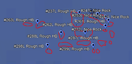
Stop fishing and start catching. New Private Reefs► 600+ private reefs posted
►Chicken coops – Pyramids – FADS – Many more
►Buy more and save with Black Friday discounts!View Private ReefsBest Hardbottom Chart Ever►Northern Gulf Coverage: Pensacola, Destin, Panama City and Mexico Beach
►Incredible natural reefs from the beach to 70 miles offshore
► Thousands of brand new reef numbers: Never before published.
►Works on: Simrad, Lowrance, Raymarine, Garmin, and others.
View Chart
Previous
Next

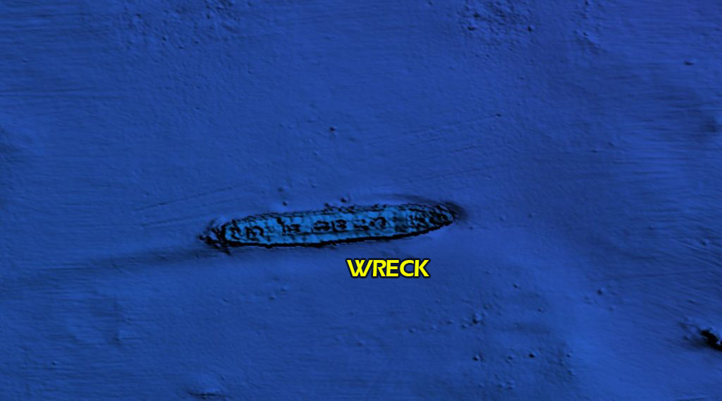
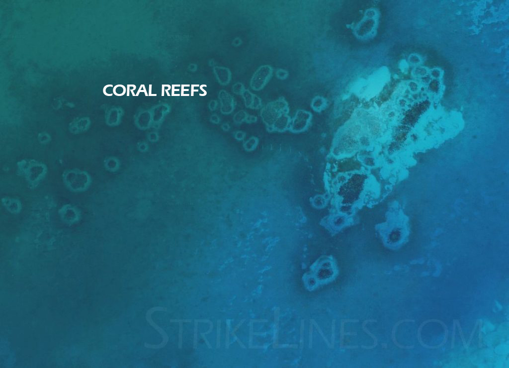
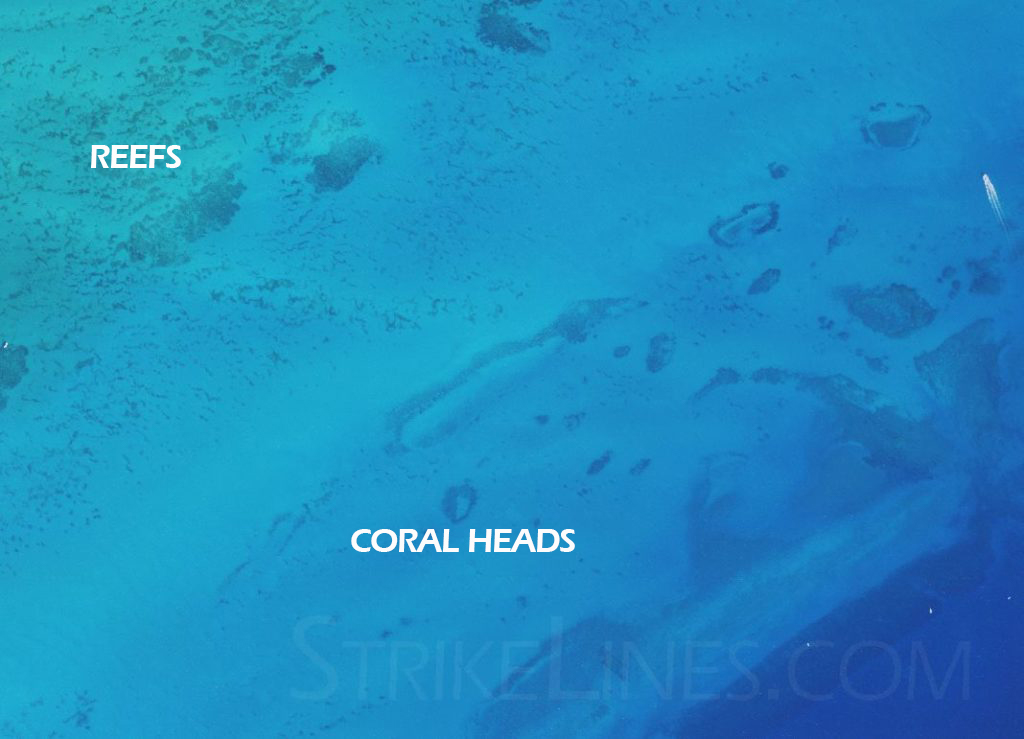
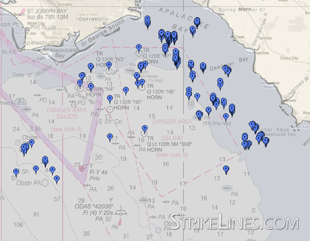
High resolution 3D maps of the seafloor. You see every detail and find the best places to fish.
Compatible with Simrad, Lowrance, Raymarine, iOS and Android devices.

We scan the seafloor with side scan sonar and mark all of the structure that holds fish.
Compatible with Garmin, Simrad, Lowrance, Raymarine, iOS and Android devices.

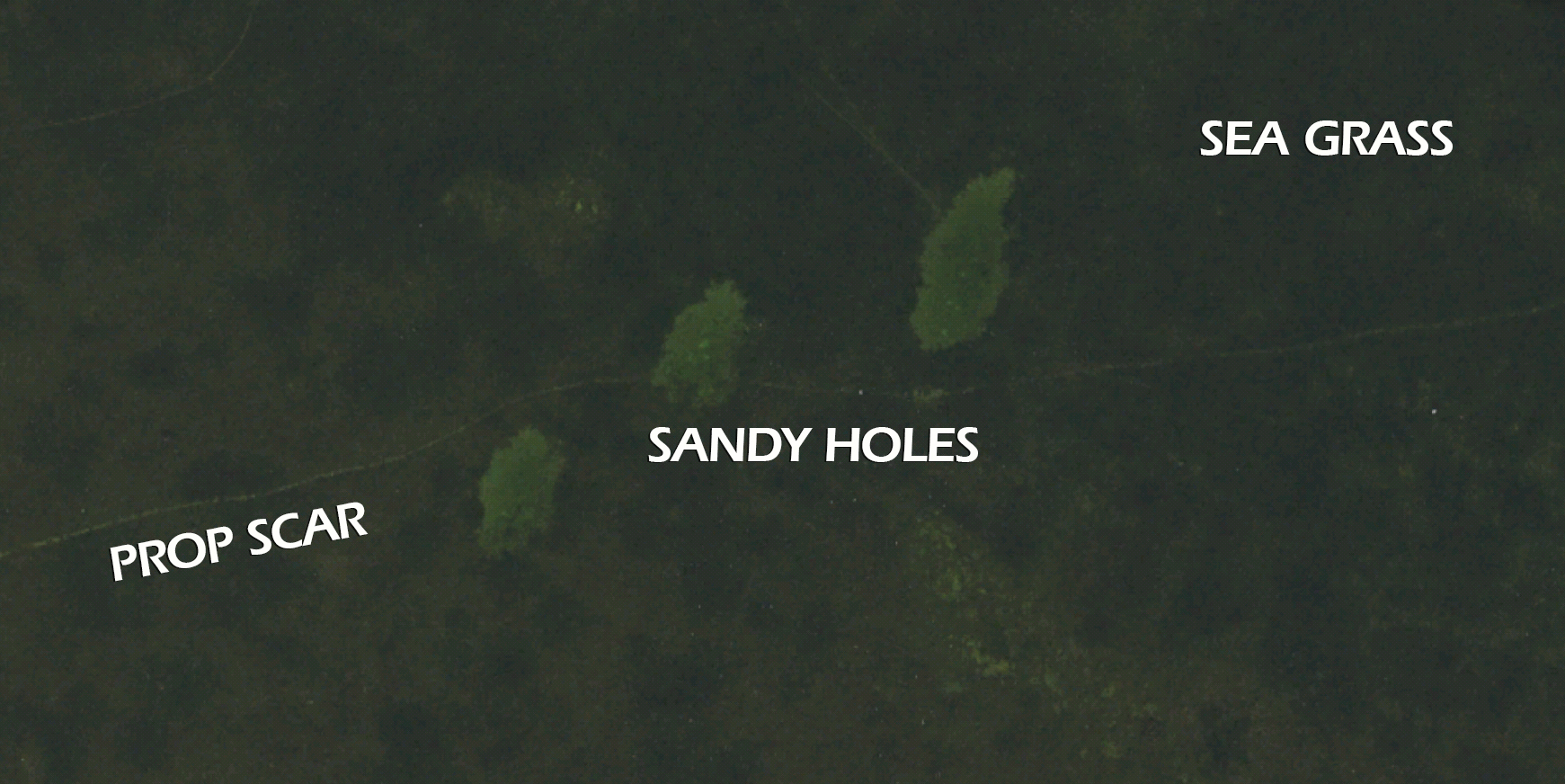
Extremely high resolution aerial imagery of inshore waters on your marine chartplotter.
Compatible with Simrad, Lowrance and Raymarine.

We locate private reefs with commercial side scan sonar, and sell the coordinates of each reef to one person only.
Gulf of Mexico only.

Hire StrikeLines for a charter sonar scan of your favorite fishing grounds.
Additional services include ROV inspection and search and recovery operations. GSA certified.
Use the map below to see fishing charts available in your area.


Never get skunked again! Our high resolution 3D charts reveal the
seafloor in more detail than you’ve ever seen before. Easily locate quality fishing
structure like wrecks, ledges, rocks, outcroppings, hardbottom, coral heads and more.

Bring ultra- high resolution aerial imagery to your chart plotter. Avoid rocks and sandbars. Run through shallow water to your favorite holes. Pick a path off the flats when the tide is falling fast. Our 4K charts are a must-have item for
serious inshore fishermen.

We use professional sonar equipment to scan thousands of miles of seafloor. We locate the very best fishable structure, and we bundle hundreds of quality spots into regional fishing charts.
We find them. You fish them!
StrikeLines Charts has changed the way we fish. Thank you for making our fishing weekends more enjoyable.

Shawnee ShirleyFlorida
I use the Long Island Sound chart and it’s 100% worth it! I don’t know how they could get more detailed.

William MaxwellConnecticut
Just moved to St Pete and bought your guys maps, literally the first spot I tried out I got my first grouper. Very impressed!

Casey SimonsFlorida
I recently used my new Southern California 3D chart to plan my dive. Came out with 3rd place at the 54th Charlie Sturgill Memorial Pole Spear Competition.

Clayton HuntCalifornia
Previous
Next


High resolution 3D maps of the seafloor. You see every detail and find the best places to fish.
Compatible with Simrad, Lowrance, Raymarine, iOS and Android devices.

We scan the seafloor with side scan sonar and mark all of the structure that holds fish.
Compatible with Garmin, Simrad, Lowrance, Raymarine, iOS and Android devices.

Extremely high resolution aerial imagery of inshore waters on your marine chartplotter.
Compatible with Simrad, Lowrance and Raymarine.

We locate private reefs with commercial side scan sonar, and sell the coordinates of each reef to one person only.
Gulf of Mexico only.

Hire StrikeLines for a charter sonar scan of your favorite fishing grounds.
Additional services include ROV inspection and search and recovery operations. GSA certified.

High resolution 3D maps of the seafloor. You see every detail and find the best places to fish.
Compatible with Simrad, Lowrance, Raymarine, iOS and Android devices.
We scan the seafloor with side scan sonar and mark all of the structure that holds fish.
Compatible with Garmin, Simrad, Lowrance, Raymarine, iOS and Android devices.
Extremely high resolution aerial imagery of inshore waters on your marine chartplotter.
Compatible with Simrad, Lowrance and Raymarine.
We locate private reefs with commercial side scan sonar, and sell the coordinates of each reef to one person only.
Gulf of Mexico only.
Hire StrikeLines for a charter sonar scan of your favorite fishing grounds.
Additional services include ROV inspection and search and recovery operations. GSA certified.
